Приказ основних података о документу
Analysis of drainage criteria as a basis for land reclamation of anizotropic soils in arid regions
Analiza drenažnih kriterijuma kao uslov melioracija višeslojnih zemljišta aridnih regiona
| dc.creator | Žeželj, Branislav | |
| dc.creator | Sekulić, Petar | |
| dc.creator | Hojka, Zdravko | |
| dc.creator | Ninkov, Jordana | |
| dc.date.accessioned | 2021-04-26T19:20:05Z | |
| dc.date.available | 2021-04-26T19:20:05Z | |
| dc.date.issued | 2015 | |
| dc.identifier.issn | 0350-2953 | |
| dc.identifier.uri | http://fiver.ifvcns.rs/handle/123456789/1470 | |
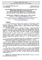
| dc.description.abstract | This study gives a detailed analysis of parameters for determination of basic criteria for field-pipe drainage, since desalinisation (Land Reclamation) and amelioration of degraded saline soils and its control require the existence of adequate ground drainage. For the purposes of drainage, pedological study was conducted and hydraulic conductivity measured in the selected horizons. Field measurements used standard augerhole method in saturated soil extract, below ground water level, for various depths to 5 m. For layers above ground water level and below it (if it was below drill depth), K- values were calculated based on: soil texture, average conductivity, via infiltration test, average filtration coefficient (100 ccm Kopecki), inverse augerhole method, while K- values for horizons of 0-2.5 and 2.5-3.5 were calculated based on the concept of transmissibility. The map of hydraulic conductivity was produced as the final result of the study, based on measured and estimated-calculated values. K-values (m/day) were classified into percentage categories (from 0.5 to gt 4.0 m/day). Since soil desalinisation has three phases (initial leaching, reclamation-transitional production of tolerant crops, and regular crop production), it is clear that the drainage systems are projected for the third phase, therefore drainage quantities are defined as those that need to go through the drainage system in a given time in a given period, in order to maintain the rhizosphere salinity at the desired level. Drainage water quantity is the same as added water quantity (leaching requirements) in order to maintain the desired salinity level (4 mmhos/cm), with 25-30% of the gross irrigation requirements. Based on the gross irrigation and drainage requirements, the drainage hydromodule was determined at q = 2 mm/day. Important factors for subsurface-pipe drainage are depth and oscillations of ground water level in the growing period, or the minimum depth, which determines the aeration value and development of plant rhizosphere. The analysis verified that the drainage system designed for permanent requirements in the regular production phase can satisfy temporary drainage requirements at the initial leaching phase. Finally, field drainage depth must be higher than minimum depth of ground water, so that hydraulic head is provided which causes movement of ground water towards the drain. Adopted field drain depth is 2.0-2.5 m. As the final result of the applied methods, and based on hydro-pedological soil properties and their analyses, the modified Hooghoudt-Ernst equation was used to calculate field drain spacing. By using the aforementioned calculation method, the drainage spacing is adopted as follows: 45 m, 60 m, 75 m, 90 m, 105 m, and 120 m, while average drainage depth is 2.3 m. | en |
| dc.description.abstract | U ovom radu prikazana je detaljna analiza parametara za determinaciju osnovnih kriterijma poljske-cevne drenaže, obzirom da desalinizacija (Land Reclamation) i poboljšanje degradiranih zaslanjenih zemljišta i njegova kontrola, zahteva postojanje adekvatne podzemne drenaže. Za potrebe drenaže, urađena su pedološka istraživanja i merenja hidrauličkog konduktiviteta izdvojenih horizonata. Poljska merenja su rađena standardnom Auger-hole metodom u saturisanom zemljišnom ekstraktu, ispod nivoa podzemne vode, za različite dubine do 5 m. Kao finalni rezultat istraživanja, sačinjena je karta hidrauličkog konduktiviteta, kako na osnovu merenih, tako i na osnovu procenjenih-sračunatih vrednosti. Vrednosti K (m/dan), svrstane su u % kategorija (od 0,5 do gt 4,0 m/dan). Drenažne količine, jednake su dodatnoj količini vode eng. 'leaching requirements', za održavanje željenog nivoa saliniteta (4 mmhos/cm), sa 25-30% od ukupnih irgacionih zahteva. Na osnovu ukupnih, potrebnih količina vode za navodnjavanje i odvodnjavanje, drenažni hidromodul koji treba koristiti za dimenzionisanje sistema je q = 2mm/dan. Bitan činilac podzemne-cevne drenaže je dubina i oscilacije novoa podzemne vode u period vegetacije. Analizom je verifikovano, da drenažni sistem, može zadovoljiti temporarne drenažne zahteve u fazi inicjalnog ispiranja. Dubina poljske drenaže mora biti veća od minimalne dubine podzemne vode, sa ciljem da se obezbedi hidraulički pritisak koji uslovljava kretanje podzemne vode ka drenu. Usvojena dubina poljske drenaže je od 2,0-2,5 m. Kao finale rezultata primenjenih metoda, a na osnovu hidro-pedoloških karakteristika zemljišta i analize istih, za proračun rastojanja poljskih drenova, korišćena je modifikovana Houghout-Ernst jednačina. Koristeći pomentu metodu proračuna, usvojena drenažna rastojanja su: 45m, 60m, 75m, 90m, 105m i 120m, dok je prosečna dubina drenaže 2,3 m. | sr |
| dc.publisher | Nacionalno naučno društvo za poljoprivrednu tehniku, Novi Sad | |
| dc.rights | openAccess | |
| dc.source | Savremena poljoprivredna tehnika | |
| dc.subject | hydraulic conductivity | en |
| dc.subject | field drainage | en |
| dc.subject | infiltration | en |
| dc.subject | transmissibility | en |
| dc.subject | drainage | en |
| dc.subject | desalinisation | en |
| dc.subject | hidraulički konduktivitet | sr |
| dc.subject | poljska drenaža | sr |
| dc.subject | infiltracija | sr |
| dc.subject | transbilitet | sr |
| dc.subject | hidromodul drenaže | sr |
| dc.subject | desalinizacija | sr |
| dc.title | Analysis of drainage criteria as a basis for land reclamation of anizotropic soils in arid regions | en |
| dc.title | Analiza drenažnih kriterijuma kao uslov melioracija višeslojnih zemljišta aridnih regiona | sr |
| dc.type | article | |
| dc.rights.license | ARR | |
| dc.citation.epage | 16 | |
| dc.citation.issue | 1 | |
| dc.citation.other | 41(1): 9-16 | |
| dc.citation.rank | M51 | |
| dc.citation.spage | 9 | |
| dc.citation.volume | 41 | |
| dc.identifier.doi | 10.5937/SavPoljTeh1501009Z | |
| dc.identifier.fulltext | http://fiver.ifvcns.rs/bitstream/id/401/1467.pdf | |
| dc.type.version | publishedVersion |


